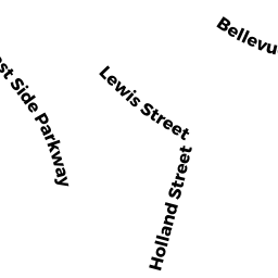
82-84 EAST SIDE PKWY
Owner Information
BEARFIELD JAMES L & CAROL A
82 EAST SIDE PKWAY
NEWTON, MA 02458


Property Details
82-84 EAST SIDE PKWY is classified as a Two-Family Residential (Two family).
The primary structure on this property was built in 1910. There are 4,538ft2 of built area within this property. There is 2,728ft2 of residential/living space within this property. This property is listed as having 10 rooms.
82-84 EAST SIDE PKWY is valued at $1,006,600. The land is valued at $608,400 and the structures are valued at $398,200.
This property is in Zone MR1. Confirm with local Zoning Board authorities to ensure there are no overlays or other easements on this property.
The most recent deed for 82-84 EAST SIDE PKWY is recorded at the local registrar in Book 13469, Page 500. 82-84 EAST SIDE PKWY was last sold on Saturday, July 22, 1978 for $54,500.
Assessment data from fiscal year 2022.
Flood Data
According to the FEMA National Flood Hazard Layer, this property does not appear to be in a flood zone. It may also be in an area not yet reviewed. Nonetheless, confirm this information prior to taking any action.
To view the flood hazards around this property, create a FEMA "Firmette" Map of the area around 82-84 EAST SIDE PKWY.
Broadband Internet Providers
| Provider | Type | Bandwidth (mbps) | |
|---|---|---|---|
| Viasat Inc | Satellite | 100 | 3 |
| Comcast | Cable | 1000 | 35 |
| RCN | Cable | 500 | 20 |
| RCN | Cable | 1000 | 20 |
| GCI Communication Corp. | Satellite | 0 | 0 |
| HughesNet | Satellite | 25 | 3 |
| VSAT Systems, LLC. | Satellite | 2 | 1 |
| Verizon New England Inc. | Fiber | 940 | 880 |
| Verizon New England Inc. | DSL | 10 | 1 |
Broadband service provider data from December 2020.
Adjacent Properties
- 76-78 EAST SIDE PKWY #76
Residential Condominium owned by MUFSON ARIANA SARAH - 76-78 EAST SIDE PKWY #78
Residential Condominium owned by BERNSON DANA L TR - 76-78 EAST SIDE PKWY
Other, Open Space owned by 76-78 EAST SIDE PKWY MASTER DEED - 29-31 LEWIS ST 31
Residential Condominium owned by HIGHT ELEANOR M - 29-31 LEWIS ST
Other, Open Space owned by 29-31 LEWIS ST MASTER DEED - 29-31 LEWIS ST 29
Residential Condominium owned by SHUE MARGARET J TR - 35-37 LEWIS ST
Two-Family Residential owned by LADIN RIVKA & ZVI TRS - 41-43 LEWIS ST
Two-Family Residential owned by SHAW HARVEY - 88 EAST SIDE PKWY
Two-Family Residential owned by FARKAS GEORGE & CLAIRE TRS